Emory’s HERCULES Exposome Research Center offers a free Community Data Workshop Series for community groups! This is a 5-session entry-level workshop that helps community groups access and use data to address their environmental health concerns. Read more about the workshop content below.
The 2026 workshop registration is now closed.
We will send confirmation emails of acceptance into the workshop by January 30th.
Please email herculesexposome@emory.edu if you have any questions or would like to be included on the outreach for future offerings.
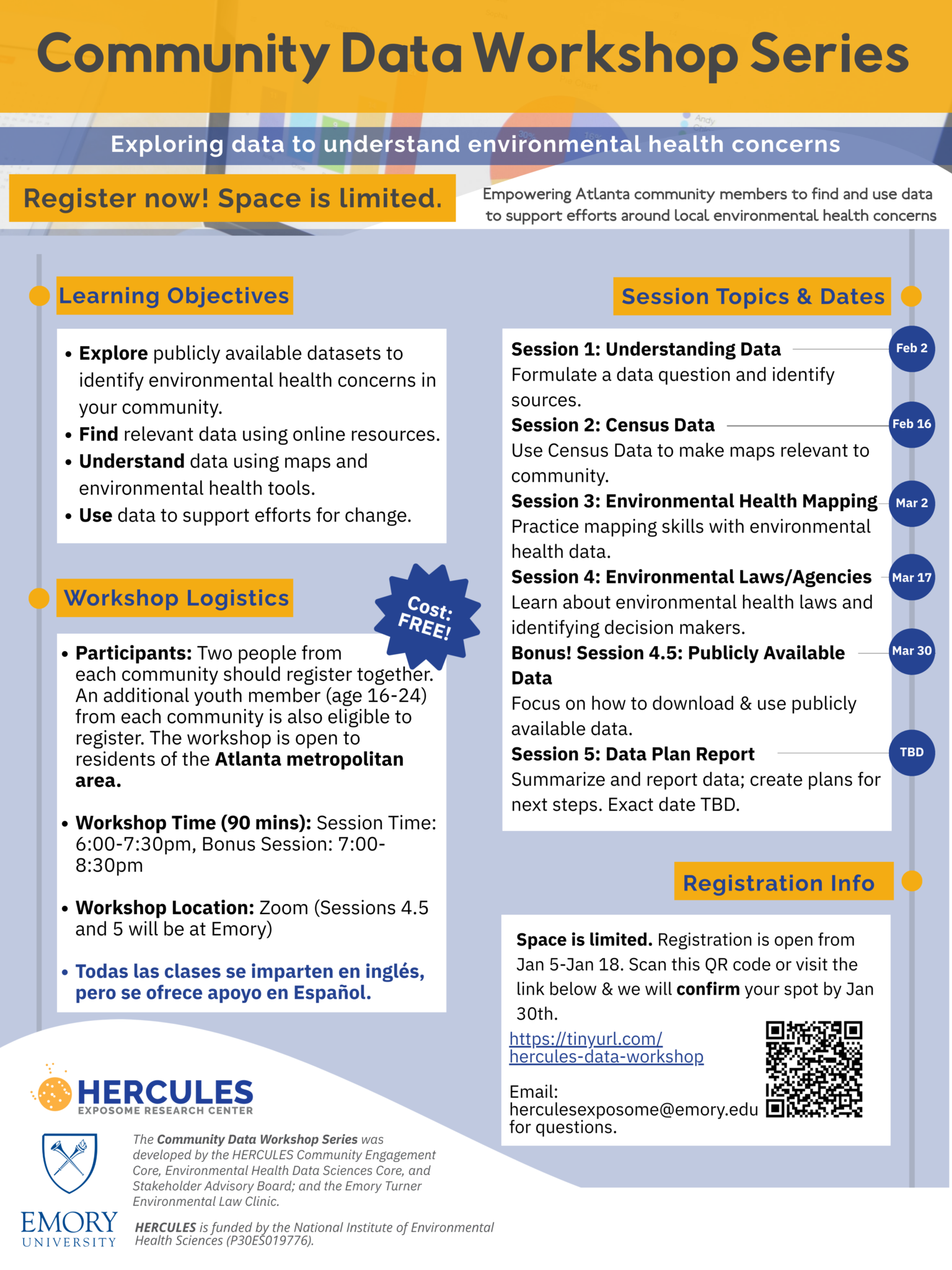

Session 1 Topics:
- Overview of using data to address community concerns
- Orienting to environmental and community data
- Types of available data
Session 2 Topics:
- Identifying relevant census tracts
- How to create and customize a map using data.census.gov
- How to access and identify relevant neighborhood data
Session 3 Topics:
- Accessing and mapping environmental health data
- Understanding “percentiles”
Session 4 Topics:
- EH related agencies (who they are, what they do)
- Laws related to specific concerns
- Rights as community scientists
- Opportunities to be involved in legal process (especially with data)
- Data requests
Session 4.5 Topics:
- Exploring publicly available datasets with TA assistance
Session 5 Topics:
- Presenting your data plan
- Discussing and identifying next steps for your community
- Connect with other community members in the program
Learning Objectives
Session 1: Understanding Data
- Describe the connections between environmental health and community health
- Understand what “publicly available data” are, and why these datasets exists (e.g., monitoring, regulatory use)
- Recognize how data can inform community concerns
- Describe the different types of data required to answer different kinds of research questions
- Begin working towards a detailed and achievable data plan to address their environmental health concern (through session 5)
Session 2: Census Data (to Create Community Maps)
- Become familiar with Census Data, including mapping census tracts relevant to community
- Identify challenges around data mapping (ex: limitations of data)
- Build capacity to independently access and interpret American Community Survey data through Census Reporter
- Connect key demographic indicators (e.g., poverty, housing, education, age, race) to their environmental health question (Sessions 2 and 3)
Session 3: Environmental Health Mapping
- Continue to expand on mapping skills that include environmental health data
- Identify how environmental health data can affect quality of life based on geographic location
- Understand the use of “percentiles” in data
Session 4: Environmental Laws and Agencies
- Identify the laws/regulations and agencies that are relevant to their specific EH concern
- Locate forms or resources for requesting data or contacting government officials
- Recognize the importance of data validity for different goals and discuss requirements for community-specific goals (standards of evidence)
- Identify opportunities to use data to support community efforts
Session 4.5: Bonus Session!
- Identify and locate a publicly available dataset independently
- Become comfortable exploring publicly available datasets, where to find them, and what they can offer
Session 5: Data Plan Report Back
- Share and communicate with non-technical audience what was learned during the data workshop series
- Identify a path forward in how this data may be helpful for the community